Loading...
Way: 200422281
Version #8
Checking sources
Tags
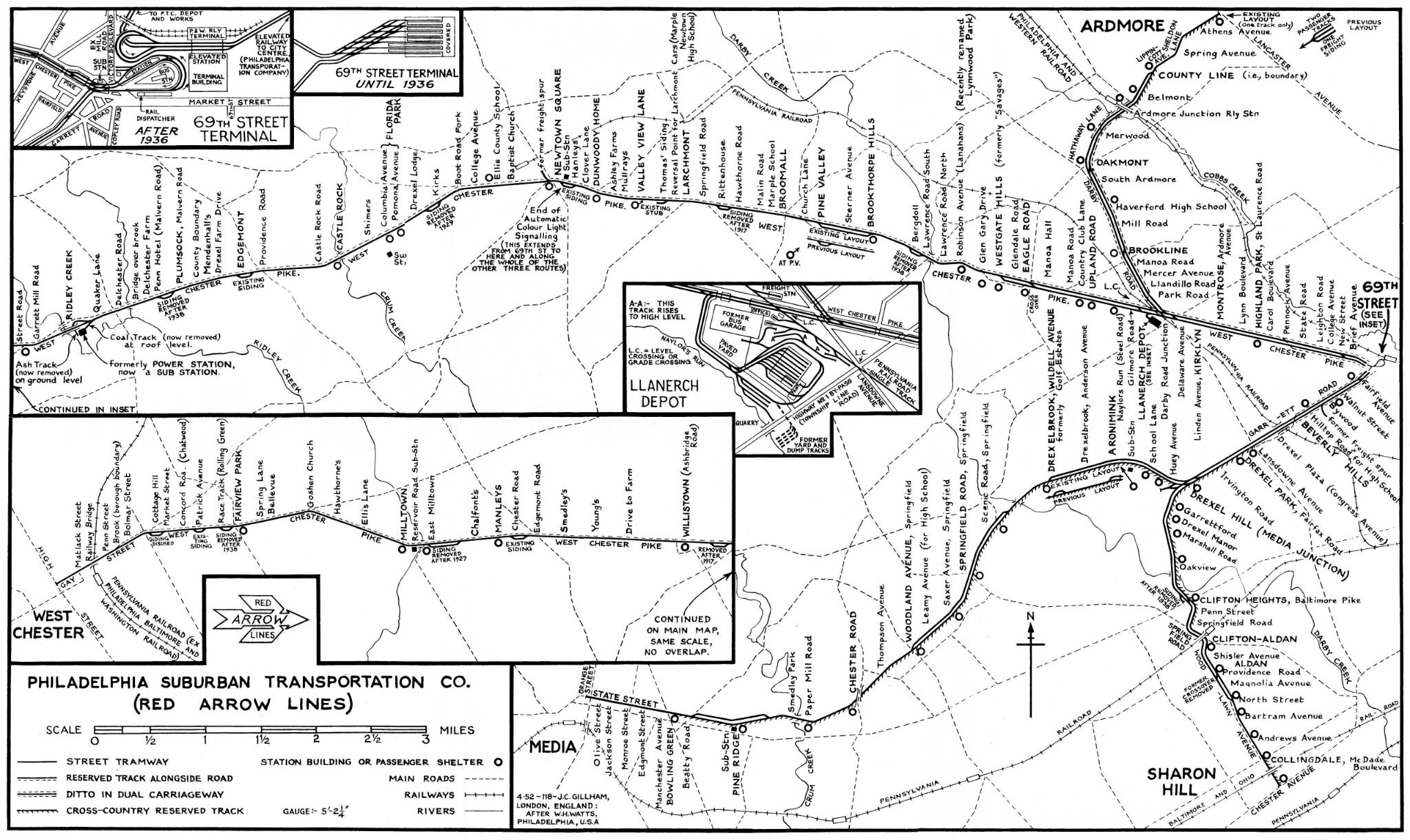
| fixme | The center of the railroad track is usually 5 feet from the edge of the road, but toward Willistown (see photos) this distance increases to 8-10 feet but it is impossible to know from where to where this extra width existed. |
|---|---|
| quality | 1 |
| source:geometry | https://ngmdb.usgs.gov/topoview/ |
| source:geometry2 | (map) Philadelphia Suburban Transportation Co. (Red Arrow Lines) 1952, collection & restauration Jim Dornberger https://i.goopics.net/fux1g2.jpg |
| source_type | railway |
| type | source |
Part of
1 relation
- Relation 2827015
Nodes
11 nodes
- 2123104144 (part of ways 200422223 and 200422234)
- 2123105480
- 2123105479
- 2123105478
- 2123105477
- 2123105476
- 2123105475
- 2123105474
- 2123105473
- 2123105472
- 2123105321 (part of way 200422276)
Welcome to OpenHistoricalMap!
OpenHistoricalMap is an interactive map of the world throughout history, created by people like you and dedicated to the public domain.
OpenHistoricalMap is a charter project of OpenStreetMap U.S., a 501(c)(3) nonprofit organization affiliated with the OpenStreetMap Foundation. Technical development is supported by GreenInfo Network and Development Seed.
| https://openstreetmap.org/copyright | https://openstreetmap.org |
| Copyright OpenHistoricalMap and contributors, under an open license | |