Loading...
Way History: 200424956
Version #6
Removing quality tags
Tags
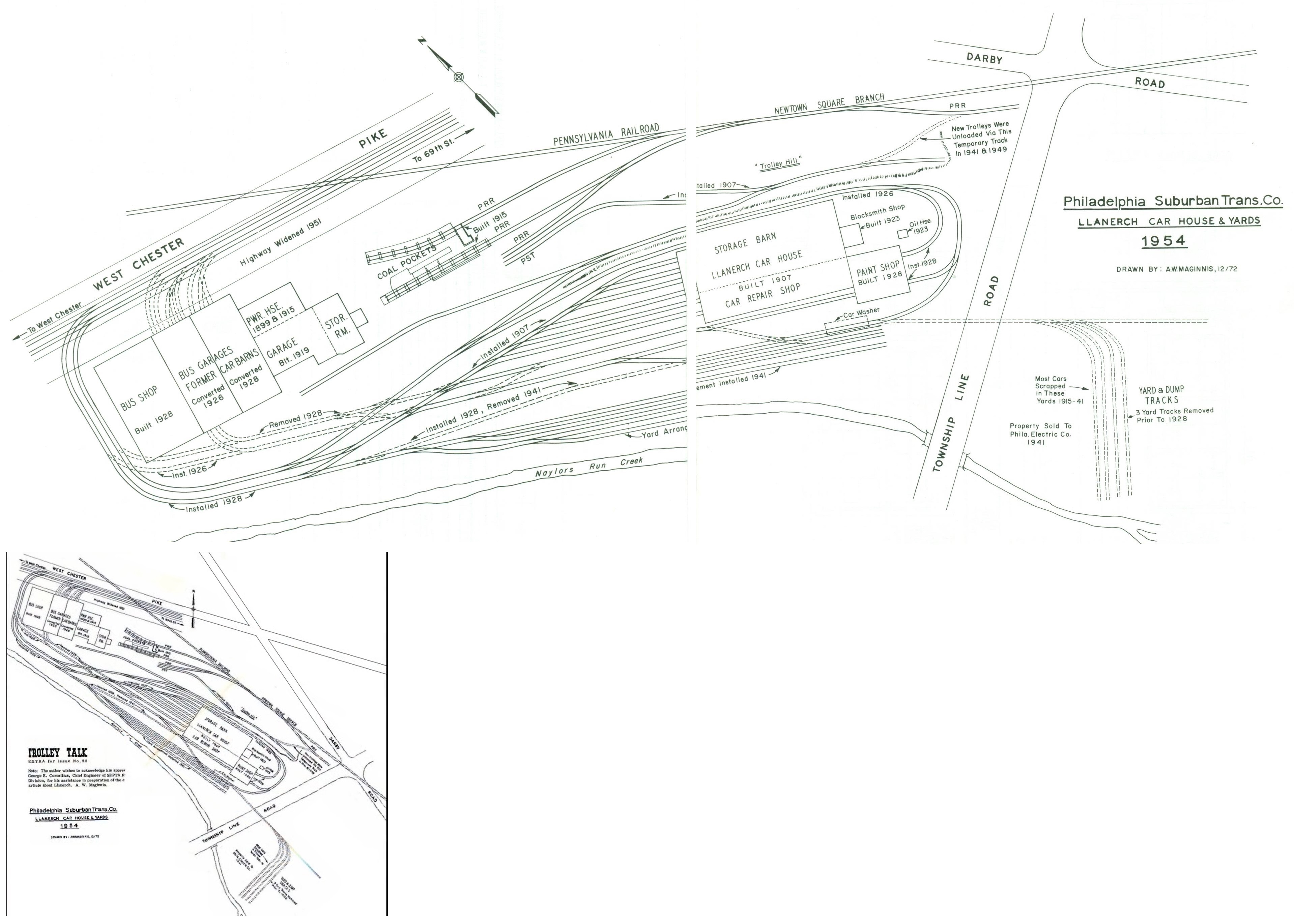
| source:geometry | Philadelphia Suburban Trans.Co. Llanerch car house & yards 1954 https://i.goopics.net/bhcnu9.jpg |
|---|---|
| source_type | railway |
| type | source |
Nodes
5 nodes
- 2123026048 (part of ways 200424941 and 200429370)
- 2123126670
- 2123126669
- 2123126668
- 2123126671 (part of ways 200424940 and 200424955)
Version #5
Checking sources
Tags
| quality | 0 |
|---|---|
| source:geometry | Philadelphia Suburban Trans.Co. Llanerch car house & yards 1954 https://i.goopics.net/bhcnu9.jpg |
| source_type | railway |
| type | source |
Nodes
5 nodes
- 2123026048 (part of ways 200424941 and 200429370)
- 2123126670
- 2123126669
- 2123126668
- 2123126671 (part of ways 200424940 and 200424955)
Version #4
Checking sources
Tags
| quality | 0 |
|---|---|
| source:geometry | Philadelphia Suburban Trans.Co. Llanerch car house & yards 1954 https://i.goopics.net/bhcnu9.jpg |
| source_not_checked | yes |
| source_type | railway |
| type | source |
Nodes
5 nodes
- 2123026048 (part of ways 200424941 and 200429370)
- 2123126670
- 2123126669
- 2123126668
- 2123126671 (part of ways 200424940 and 200424955)
Version #3
Checking sources
Tags
| quality | 0 |
|---|---|
| source | Philadelphia Suburban Trans.Co. Llanerch car house & yards 1954 https://i.goopics.net/bhcnu9.jpg |
| source_not_checked | yes |
| source_type | railway |
| type | source |
Nodes
5 nodes
- 2123026048 (part of ways 200424941 and 200429370)
- 2123126670
- 2123126669
- 2123126668
- 2123126671 (part of ways 200424940 and 200424955)
Version #2
(no comment)
Tags
| quality | 0 |
|---|---|
| source | Philadelphia Suburban Trans.Co. Llanerch car house & yards 1954 https://i.goopics.net/bhcnu9.jpg |
| source_type | railway |
| type | source |
Nodes
5 nodes
- 2123026048 (part of ways 200424941 and 200429370)
- 2123126670
- 2123126669
- 2123126668
- 2123126671 (part of ways 200424940 and 200424955)
Version #1
Red Arrow lines - Llanerch depot
Tags
| quality | 0 |
|---|---|
| source | Philadelphia Suburban Trans.Co. Llanerch car house & yards 1954 |
| source_type | railway |
| type | source |
Nodes
5 nodes
- 2123026048 (part of ways 200424941 and 200429370)
- 2123126670
- 2123126669
- 2123126668
- 2123126671 (part of ways 200424940 and 200424955)
Welcome to OpenHistoricalMap!
OpenHistoricalMap is an interactive map of the world throughout history, created by people like you and dedicated to the public domain.
OpenHistoricalMap is a charter project of OpenStreetMap U.S., a 501(c)(3) nonprofit organization affiliated with the OpenStreetMap Foundation. Technical development is supported by GreenInfo Network and Development Seed.
| https://openstreetmap.org/copyright | https://openstreetmap.org |
| Copyright OpenHistoricalMap and contributors, under an open license | |