Loading...
Way History: 200424942
Version #2
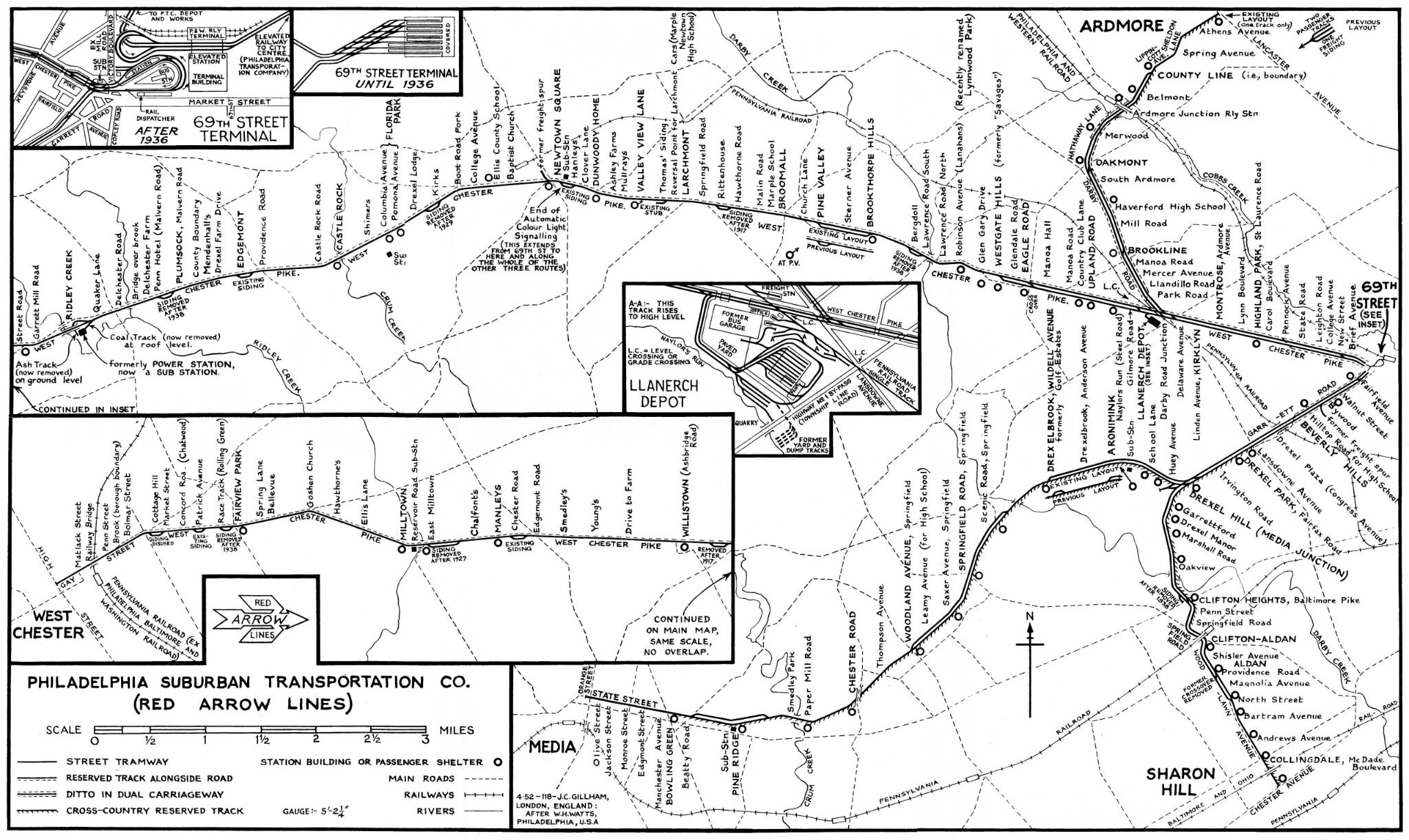
Red Arrow lines - Llanerch depot
Tags
| quality | 1 |
|---|---|
| source | Lansdowne, PA, 1942 https://ngmdb.usgs.gov/topoview/ |
| source2 | (map) Philadelphia Suburban Transportation Co. (Red Arrow Lines) 1952, collection & restauration Jim Dornberger https://i.goopics.net/fux1g2.jpg |
| source:guide | Mapbox satellite |
| source_type | railway |
| type | source |
Nodes
8 nodes
- 2123126321 (part of ways 200424940, 200425078, and 200424886)
- 2123026421 (part of way 200424940)
- 2123126683 (part of ways 200424940 and 200424960)
- 2123126684 (part of ways 200424940 and 200424961)
- 2123126714 (part of ways 200424940 and 200424963)
- 2123126713 (part of ways 200424940 and 200424947)
- 2123026420 (part of way 200424940)
- 2123126671 (part of ways 200424940, 200424955, and 200424956)
Version #1
Red Arrow lines - Llanerch depot
Tags
| quality | 1 |
|---|---|
| source | Lansdowne, PA, 1942 https://ngmdb.usgs.gov/topoview/ |
| source2 | (map) Philadelphia Suburban Transportation Co. (Red Arrow Lines) 1952, collection & restauration Jim Dornberger https://i.goopics.net/fux1g2.jpg |
| source:guide | Mapbox satellite |
| source_type | railway |
| type | source |
Nodes
5 nodes
- 2123126321 (part of ways 200424940, 200425078, and 200424886)
- 2123026421 (part of way 200424940)
- 2123026420 (part of way 200424940)
- 2123026419 (part of ways 200424955 and 200429371)
- 2123052189 (part of ways 200418777 and 200429371)
Welcome to OpenHistoricalMap!
OpenHistoricalMap is an interactive map of the world throughout history, created by people like you and dedicated to the public domain.
| https://openstreetmap.org/copyright | https://openstreetmap.org |
| Copyright OpenHistoricalMap and contributors, under an open license | |