Loading...
Way: 200365421
Version #7
Kortrijk adding roads
Tags
| ! | please do not delete |
|---|---|
| quality | 0 |
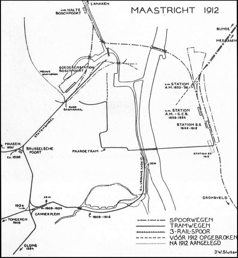
| source:geometry | JW Sluiter, Map of train and tram tracks Maastricht https://i.goopics.net/s1lvl9.jpg |
| source_type | railway |
| type | source |
Part of
4 relations
- Relation [1909-1916] 484 (2826024)
- Relation 1909-1916 ∅ (2825995)
- Relation [1909-1916] 479 (2825968)
- Relation [1909-1916] 485 (2825882)
Nodes
46 nodes
- 2122518970 (part of way 200365423)
- 2122518969
- 2122518968
- 2122518967
- 2122518966
- 2122518965
- 2122518964
- 2122518885
- 2122518886
- 2122518887
- 2122518888
- 2122518889
- 2122518890
- 2122518891
- 2122518892
- 2122518893
- 2122518919
- 2122518920
- 2122518910
- 2122518909
- 2122518908
- 2122518907
- 2122518906
- 2122518905
- 2122518904
- 2122518903
- 2122518902
- 2122518901
- 2122518900
- 2122518899
- 2122518898
- 2122518897
- 2122518896
- 2122518895
- 2122518894
- 2122518915
- 2122518914
- 2122518913
- 2122518912
- 2122518911
- 2122518918
- 2122518917
- 2122518916
- 2122518873
- 2122518872
- 2122518871 (part of way 200365422)
Welcome to OpenHistoricalMap!
OpenHistoricalMap is an interactive map of the world throughout history, created by people like you and dedicated to the public domain.
OpenHistoricalMap is a charter project of OpenStreetMap U.S., a 501(c)(3) nonprofit organization affiliated with the OpenStreetMap Foundation. Technical development is supported by GreenInfo Network and Development Seed.
| https://openstreetmap.org/copyright | https://openstreetmap.org |
| Copyright OpenHistoricalMap and contributors, under an open license | |