Loading...
Way: 198581490
Version #2
Added and modified places
Tags
| highway | primary |
|---|---|
| note | Start date unknown |
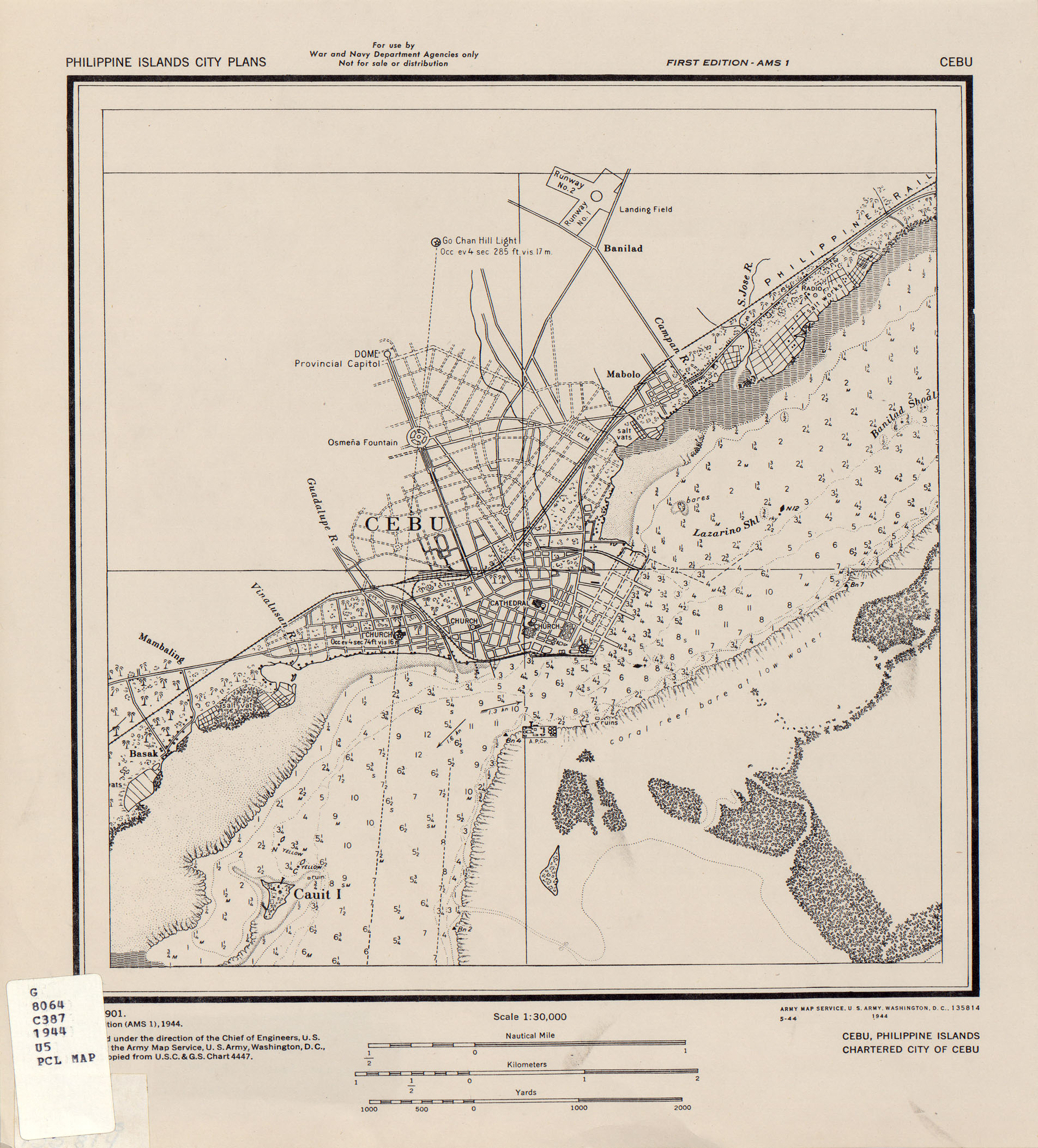
| source | http://legacy.lib.utexas.edu/maps/ams/philippines_city_plans/txu-pclmaps-oclc-6527810-cebu.jpg |
| start_date | 1941 |
Nodes
43 nodes
- 2091190337 (part of way 198581047)
- 2091190338
- 2091190339
- 2091190340
- 2091190341 (part of way 198748353)
- 2091190342
- 2091190343
- 2091190344 (part of way 198747696)
- 2091190345
- 2091190346
- 2091190347
- 2091190348
- 2091190349
- 2091190350
- 2091190351
- 2091190352
- 2091190353
- 2091190354
- 2091190355
- 2091190356
- 2091190357
- 2091190358
- 2091190359
- 2091190360 (part of way 198747695)
- 2091190361
- 2091190362
- 2091190363
- 2091190364
- 2091190365
- 2091190366
- 2091190367
- 2091190368
- 2091190369
- 2094772922 (part of way 198747694)
- 2091190370
- 2091190377 (part of way 198581491)
- 2091190371
- 2091190372
- 2091190373
- 2091190374
- 2091190375
- 2091190376
- 2091184097 (part of way 198581046)
Welcome to OpenHistoricalMap!
OpenHistoricalMap is an interactive map of the world throughout history, created by people like you and dedicated to the public domain.
OpenHistoricalMap is a charter project of OpenStreetMap U.S., a 501(c)(3) nonprofit organization affiliated with the OpenStreetMap Foundation. Technical development is supported by GreenInfo Network and Development Seed.
| https://openstreetmap.org/copyright | https://openstreetmap.org |
| Copyright OpenHistoricalMap and contributors, under an open license | |