Loading...
Way: Falderstraße (198579255)
Version #8
Editing
Tags
| highway | residential |
|---|---|
| name | Falderstraße |
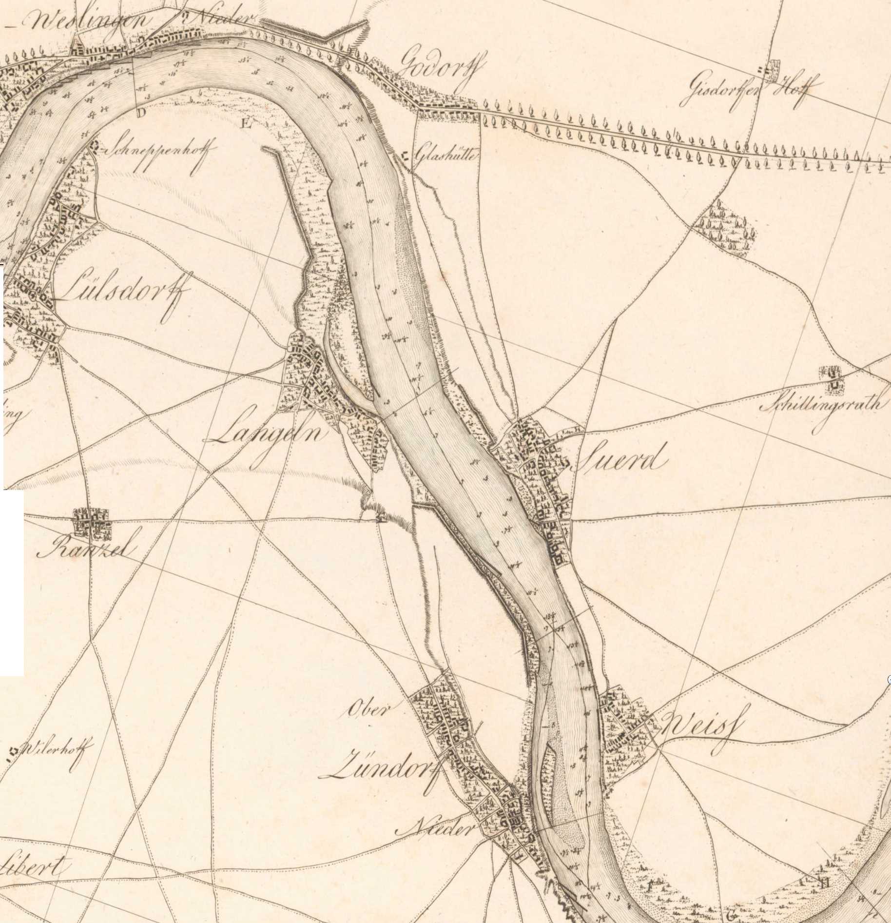
| note | Straße existiert vmtl. seit spätestens 1750, da Gebäude aus der Zeit erhalten sind. Auf Karten ist sie seit spätestens 1798 sichtbar. |
| source | http://suerth-digital.de/karten/1798.jpg |
| start_date | 1750 |
Nodes
13 nodes
- 2091153285 (part of ways Sürther Hauptstraße (198583470) and Sürther Hauptstraße (198643385))
- 2091336485
- 2091153287
- 2102580864 (part of way 199544810)
- 2091153288
- 2091153286
- 2091181144 (part of way 198580700)
- 2091153289
- 2091153290
- 2091153291
- 2091153292
- 2091153307 (part of way Bergstraße (198580781))
- 2091153282 (part of ways Ober Buschweg (198651525), Ober Buschweg (198651524), Heinrich-Erpenbach-Straße (198580732), Rodderweg (198588762), and Bahnhofstraße (198579253))
Welcome to OpenHistoricalMap!
OpenHistoricalMap is an interactive map of the world throughout history, created by people like you and dedicated to the public domain.
OpenHistoricalMap is a charter project of OpenStreetMap U.S., a 501(c)(3) nonprofit organization affiliated with the OpenStreetMap Foundation. Technical development is supported by GreenInfo Network and Development Seed.
| https://openstreetmap.org/copyright | https://openstreetmap.org |
| Copyright OpenHistoricalMap and contributors, under an open license | |