Loading...
Way: 198531976
Version #2
start_date fixes (St. Gallen)
- Edited by Hannes Röst
- Changeset #9918
Tags
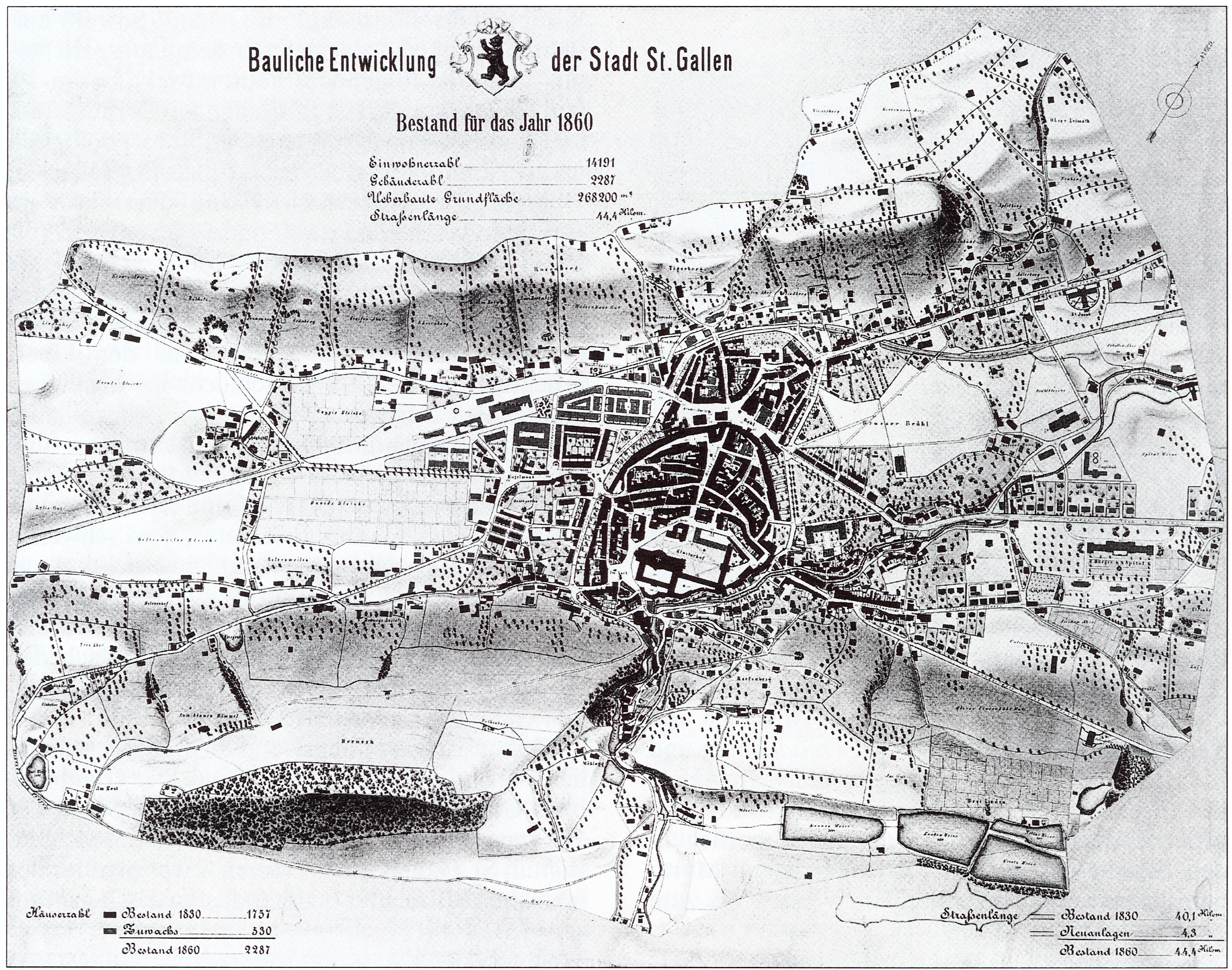
| as_of | 1860 |
|---|---|
| highway | secondary |
| source | Map of 1860 |
| source:url | https://upload.wikimedia.org/wikipedia/commons/a/a8/StGallen1860b_retouched.jpg |
| start_date | 1860 |
Nodes
12 nodes
- 2090196770 (part of way 198531990)
- 2090196636 (part of way 198531973)
- 2090196635
- 2090196634 (part of way 198531974)
- 2090196633
- 2090196632
- 2090196609 (part of way 198531972)
- 2090196631
- 2090196630
- 2090196629 (part of way 198531975)
- 2090196628
- 2090196845 (part of ways 198531997 and 198531998)
Welcome to OpenHistoricalMap!
OpenHistoricalMap is an interactive map of the world throughout history, created by people like you and dedicated to the public domain.
OpenHistoricalMap is a charter project of OpenStreetMap U.S., a 501(c)(3) nonprofit organization affiliated with the OpenStreetMap Foundation. Technical development is supported by GreenInfo Network and Development Seed.
| https://openstreetmap.org/copyright | https://openstreetmap.org |
| Copyright OpenHistoricalMap and contributors, under an open license | |