Loading...
Changeset: 7846
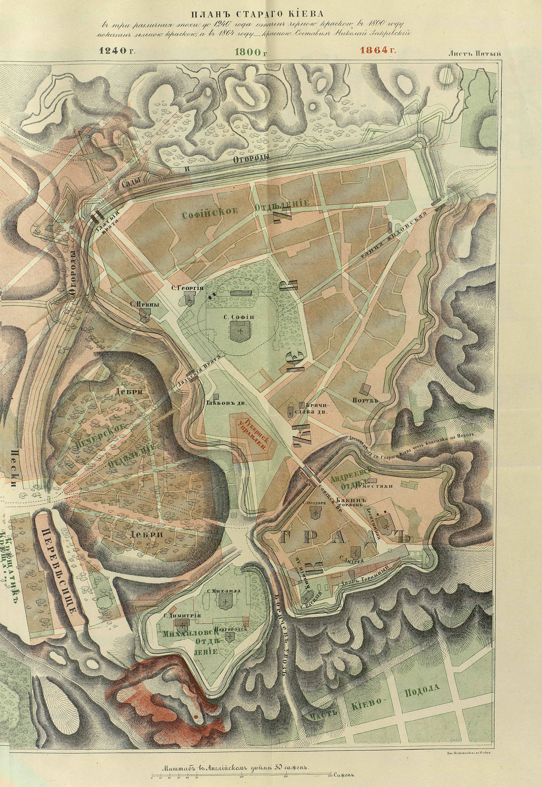
Podil before 1803
Closed by Charles Alexis Gérard
Tags
| changesets_count | 4 |
|---|---|
| created_by | iD 2.13.1 |
| host | https://www.openhistoricalmap.org/edit |
| ideditor:walkthrough_progress | welcome;startEditing |
| ideditor:walkthrough_started | yes |
| imagery_used | Custom (http://mapwarper.net/maps/tile/47862/{z}/{x}/{y}.png) |
| locale | fr |
| source | https://upload.wikimedia.org/wikipedia/commons/6/60/Kyev_Zakrvsky_map_05.png;https://upload.wikimedia.org/wikipedia/commons/7/73/Kiow_map_by_Melenskyi_%28General_plan%29_1803.png;http://mapwarper.net/maps/47862#Preview_Rectified_Map_tab |
Discussion
Ways (19)
- 198310495, v2
- 198310496, v2
- 198310497, v2
- 198310498, v2
- 198310499, v2
- 198310509, v2
- 198310510, v2
- 198310512, v2
- 198310515, v2
- 198310521, v2
- 198310522, v2
- 198310523, v2
- 198310524, v1
- 198310525, v1
- Bell tower and entrance (198310526), v1
- Богоявленський собор (198310527), v1
- 198310528, v1
- Fountain of Samson (198310529), v1
- Петропавлівська церква (198310530), v1
Nodes (81-100 of 204)
Welcome to OpenHistoricalMap!
OpenHistoricalMap is an interactive map of the world throughout history, created by people like you and dedicated to the public domain.
OpenHistoricalMap is a charter project of OpenStreetMap U.S., a 501(c)(3) nonprofit organization affiliated with the OpenStreetMap Foundation. Technical development is supported by GreenInfo Network and Development Seed.
| https://openstreetmap.org/copyright | https://openstreetmap.org |
| Copyright OpenHistoricalMap and contributors, under an open license | |